Courtenay Katherine

COMODORO RIVADAVIA – PUERTO MADRYN

Nov. 20, Comodoro Rivadavia to Puerto Madryn

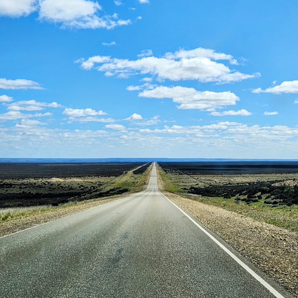
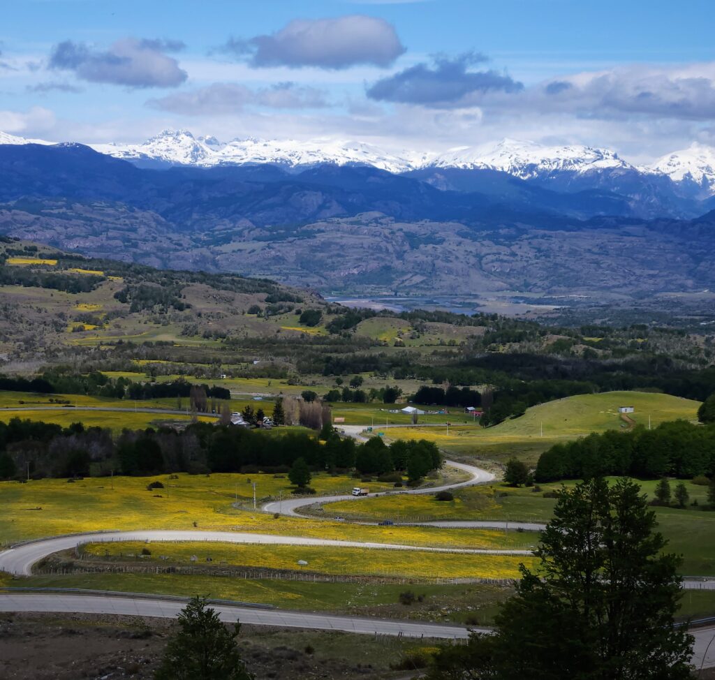
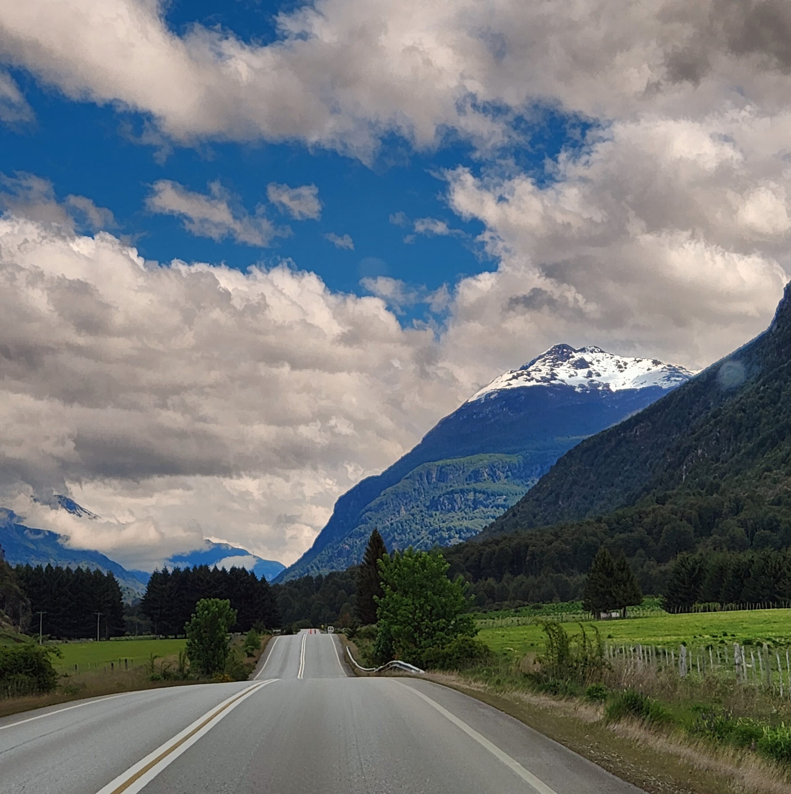
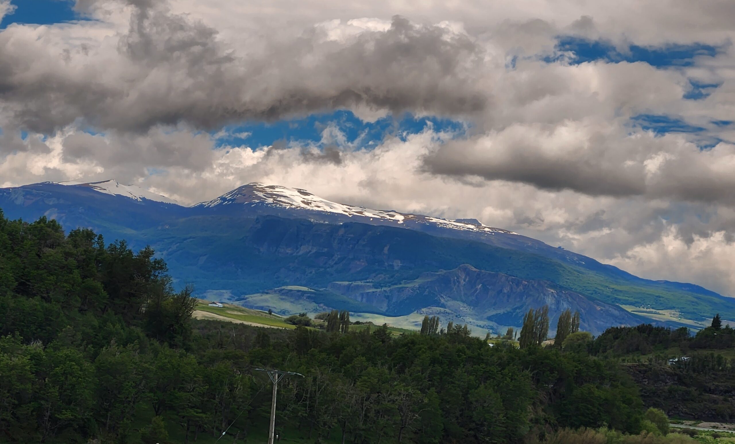
We had a 5-hour drive ahead and so in high winds, we left around 10:30 to have some time to relax in Puerto Madryn. A divided lane highway along the coast out of town passed oil refineries and other industries, and then we came up onto two-way route 3 with rolling, green, desert, scrub hills (again, reminiscent of Texas) as the road turned inland all the way to Puerto Madryn. We were driving in the highest winds we’ve encountered yet and more bad roads added to the challenging driving. And in the midst of the ridiculous winds, we were now thinking “Oklahoma, where the wind comes rolling down the plain,” or Kansas.

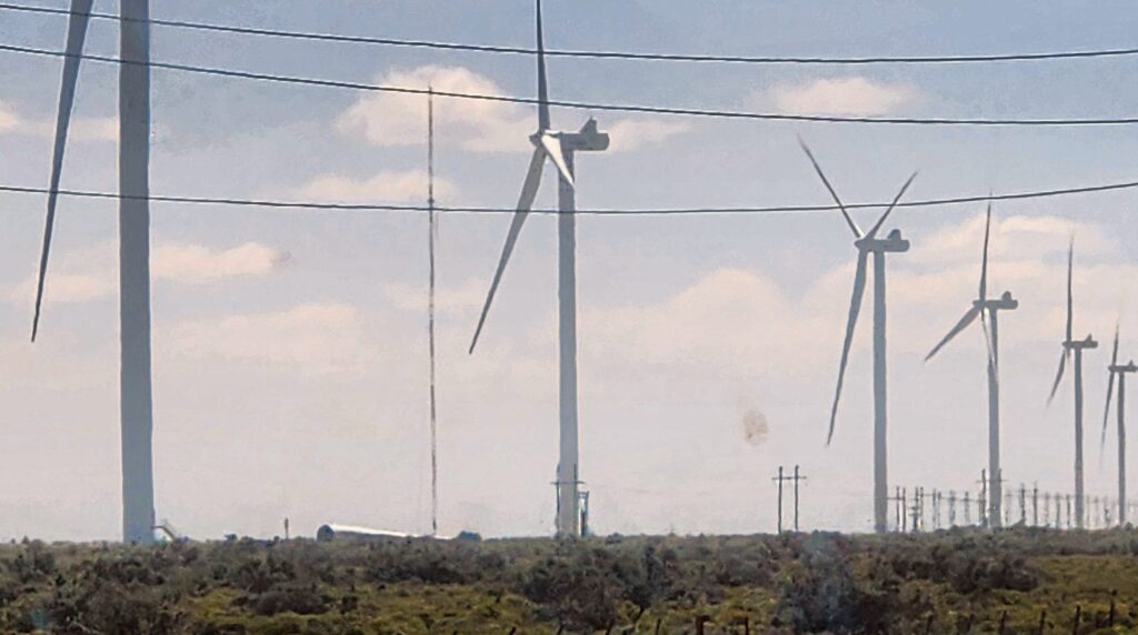
After a couple of hours, we saw a wind farm in the distance. We stopped at an old gas station with a very small, sparse store in the middle of nowhere. Nothing. I didn’t even try to photograph it because of the wind, but also because its solitary, lonely, windswept remoteness wouldn’t have come through in an image.
 
With an hour to go, we dropped down from the prairie among huge, sandy hills and dunes to the town of Trelew, an old rail town. Then high, tan grasses interspersed with clumps of eucalyptus and other greenery appeared for a bit and disappeared, and again, on the outskirts of that small town, sadly, lots of trash was strewn everywhere along the road; then we turned due north on Route 3. Another divided highway headed toward another plateau,  this one with dozens, if not hundreds, of windmills whirling. The temperature was suddenly 26 degrees Celsius.
 
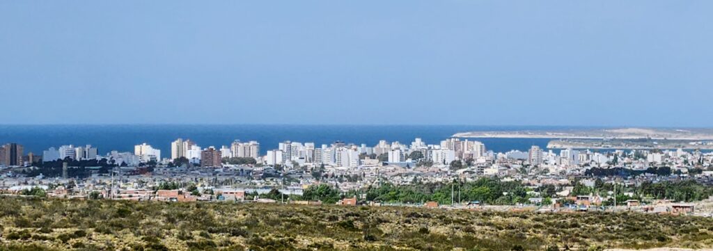
Finally, with the wind behind us, we blew downhill into Puerto Madryn, a huge city on the New Gulf  Bay that spread before us with the Atlantic Ocean beyond. We drove along the western edge of the city to avoid the traffic and arrived at our beautiful hotel in a lovely neighborhood on the south side.
 
LINK TO THE COMODORO RIVADAVIA to PUERTO MADRYN LEG IS HERE (including seals, described below):
 
 
Nov. 21, Peninsula Valdes Nature Preserve
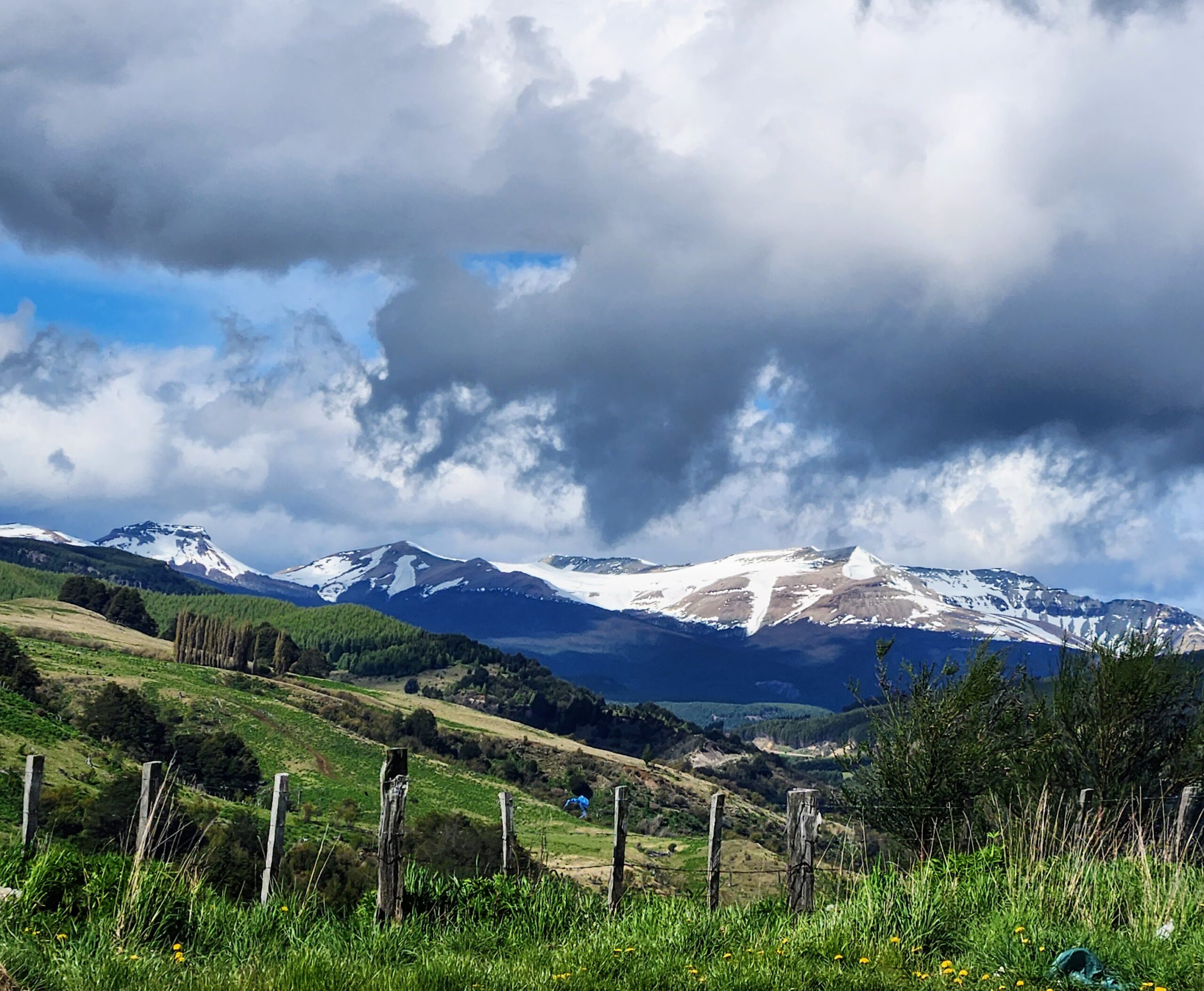
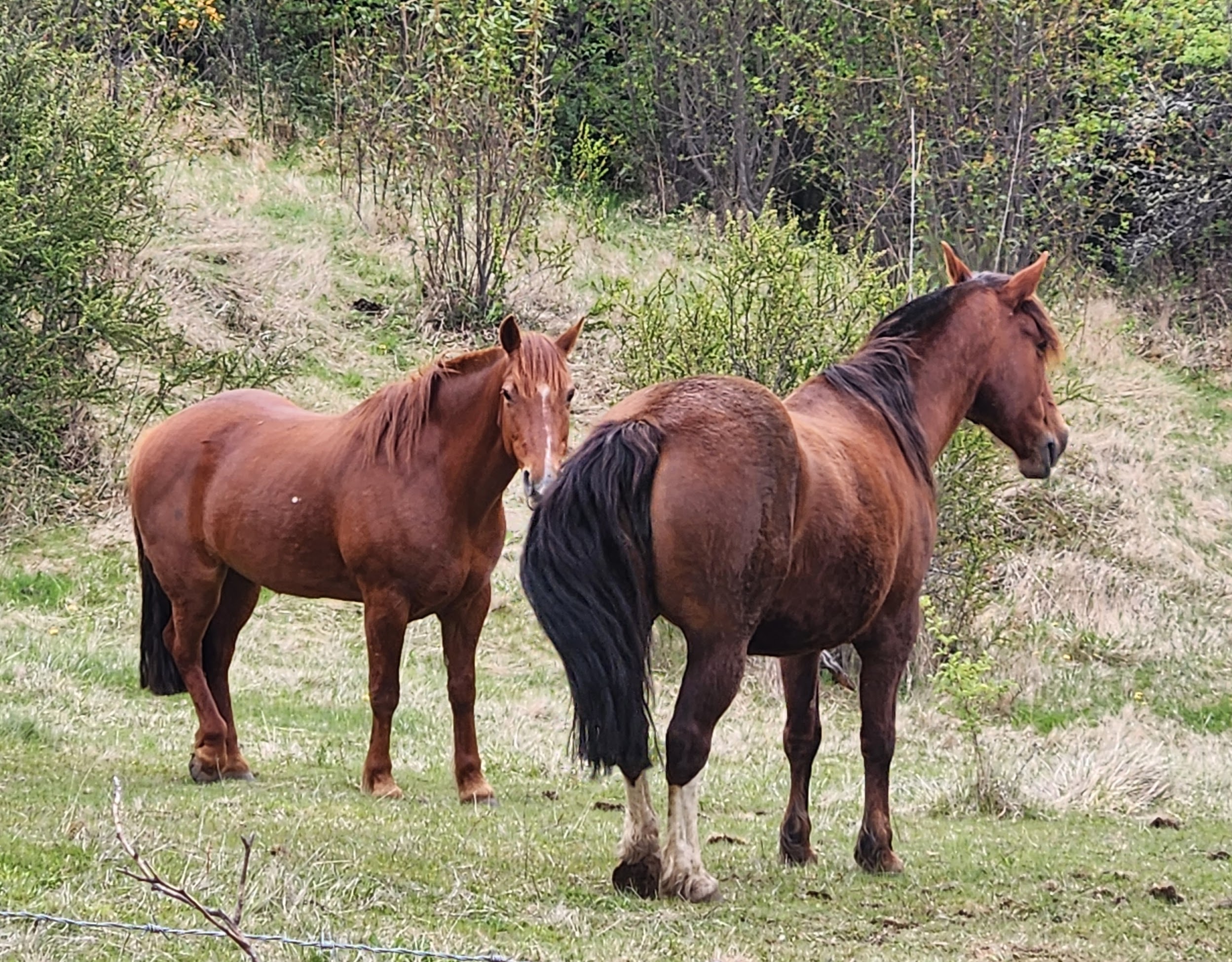
The Reserve encompasses 4000 square kilometers and is made up of 98% private sheep estancias (ranches). There must be dozens because we were able to discern the boundaries by the clear fencing, and by the frequent cattle guards we passed through on the roads. We saw a few cows, but mostly sheep all over. The terrain throughout most of the reserve is the same green scrub we have seen nonstop for days throughout this part of Patagonia. However, closer to the ocean, it turns to dry yellow prairie with occasional century plants blooming.
 
A number of roads in the reserve are closed, but we drove out 90km from the  Visitors Center on “good” dirt roads to Punto Delgada. In addition to the plentiful guanacos and Marino sheep, we passed two large salt “pans” inland, many kilometers away from any water. The largest appeared to be carved into the land with towering cliffs behind it. There were no overlooks and it was impossible to get more than a glimpse of each of them. I was lucky one photo came out.
 
A huge sky spread out over a flat prairie with coastal, bluish grasses and lots of sand appeared as we approached Punto Delgada and the ocean. We were lucky to spot a solo Nandu walking about before passing the point (just an Estancia with no sea view) before turning up the coast and heading to Caleta Valdez.
 
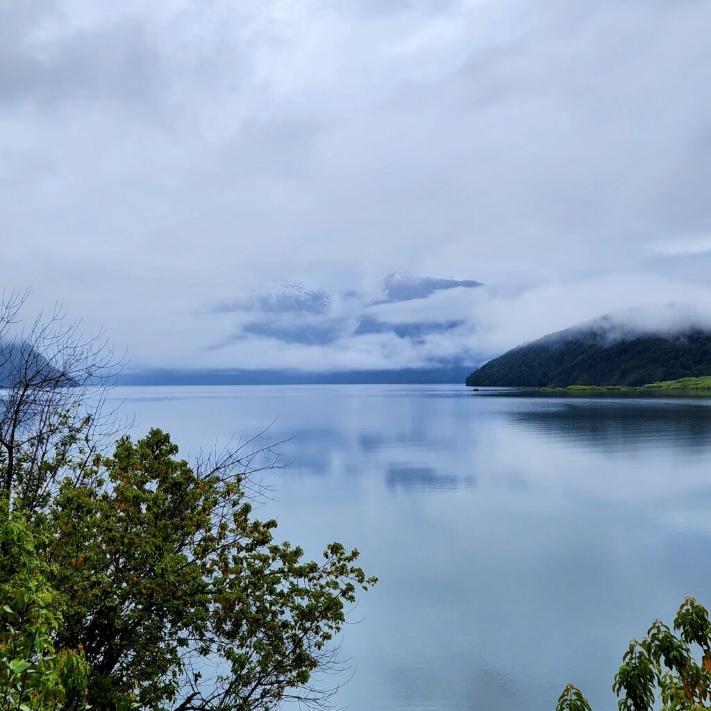
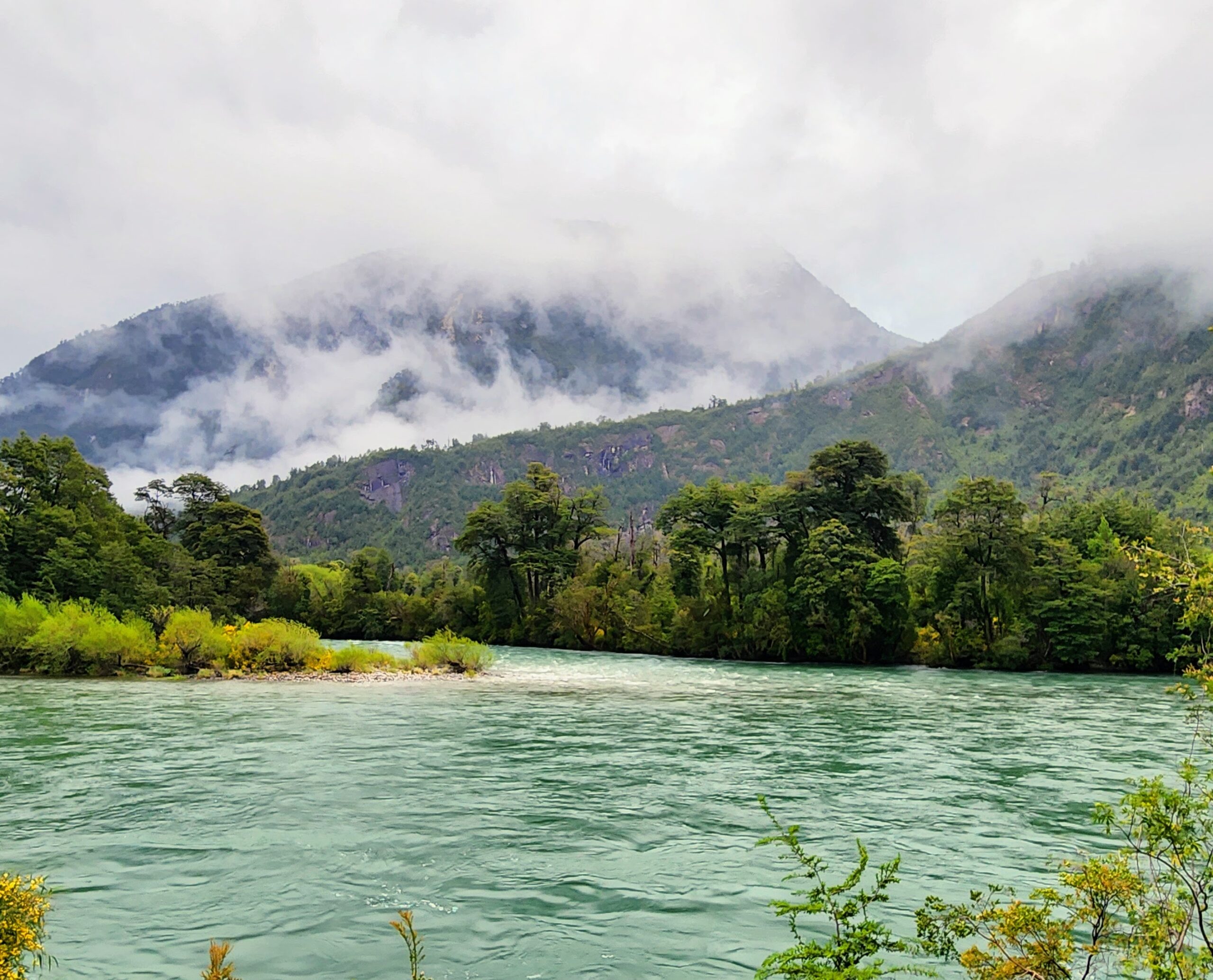
Driving along the coast was a bit of a disappointment for much of the way because of the big, grassy, sandy dunes high on the ocean side, preventing a good view until we reached Caleta Vadez. And, what a view once there! It is an incredible, coast with high bluffs rising out of the sea and sandy beaches mixed with dunes and black rocks jutting into the water as far as the eye can see.
 
The small, cash-only restaurant featured a plate of the day, a lamb burger with fries, which Knox was all over! Then we took a short, VERY WINDY walk along the shore to see the hundreds of elephant seals, many bulls with their harems lined up in groups along the beach, some sunning, some swimming, some fighting. 
 
The rest of the shore road up to Punto Norte was closed so we headed back inland and out another road, and a huge salt flat (as opposed to pan) revealed itself in the distance to our left. At Punto Norte, there were several more cliffside paths from which to view the beaches, and we saw more elephant seals and some sea lions, as well. Unfortunately, no orcas for us today, but fortunate for the sea lions for sure! Apparently,  yesterday they had a sighting, though.
 
Herds of guanacos were out on the sides of the road and in the fields on the way back. And, finally, I was able to get some decent footage of them, but as you’ll see, they’re still fond of turning their backs to me as I attempt to snap a picture or video.
 
We returned to the hotel through the main part of town. A large boardwalk lined by a park with shops, hotels, and restaurants and a bustling city center blocks from the Gulf lit by the light off of the water brings Miami to mind.
 
La Pasado de Madryn Hotel:
A 30-year-old, well-maintained, modest hotel with 33 rooms. Lovely, comfortable common areas with a bar and a beautiful garden and swimming pool. Pleasant staff. Great breakfast and fantastis dinner menu.
 

COMODORO RIVADAVIA – PUERTO MADRYN Read More »

RIO GALLEGOS – COMODORO RIVADAVIA

Nov. 19, Rio Gallegos to Comodoro Rivadavia

After breakfast, we took a brisk walk in sunny, 8-degree Celsius weather 5 blocks to the comisaría (police station) to officially get our authorization of “no emision de voto,” (non-casting of vote) that says we are too far away from our place of residence to vote. We packed up and were on the road by 10 a.m.

Heading out of the Rio Gallegos westward with the River Gallegos to our right and its cliffs rising up behind the remaining warehouses and industry we passed, again we climbed up to the coastal plains and more prairie, now reminding us of parts of Texas — straight, flat and dry for miles and miles with occasional undulating prairie, but with guanacos everywhere (they are difficult to photograph because they gallop off so fast). As Route 3 moved closer to the ocean, the brown grasses gave way to greenish shrubs extending as far as the horizon. Knox was happy with the Santa Cruz Province roads, which are in superb condition.

For a moment we came down into a valley and the highway led us through a beautiful mini estuary full of flamingos, cormorants and all manner of birds feeding and fluttering about. A bit further over a rise, another inlet revealed a sandy riverbed that looked like at one time it had been full of water. A steady climb up rolling brown and green hills returned us to the coastal plain. An hour or so later we entered Monte Leon Park, the green scrubby plains continued and then wound around rolling hills, the road lined by low white and yellow wildflowers and numerous guanacos and sheep near the road. To the northwest, black shapes like mesas or buttes rose, shimmering, far in the distance. 

We came over some more hills dropping off the plateau to, finally, the ocean, we thought. But we had arrived in Puerto San Julian at low tide so we could barely see the water in the distance past the sand. As we circumvented the city, more warehouses went on for ages on the edge of town, and we passed a salt lake and climbed up again to more high plains, and more wildflowers. Our cruising speed was about 160 kph.

We chased a pack of four motorcycles for a long while at a very fast pace with guanacos and horses grazing in the distance as we whizzed by. We passed the motorcycles and the landscape turned desert brown again with hilly mirages looming on the horizon, hazy, white, wispy clouds hanging low and blue slivers peeking through. Still, very windy.

The great roads did not stretch the length of Santa Cruz Province. Crossing into different counties (“departmentos”) often meant a drastic change in road conditions, from smooth to quite poor. We were forced to swerve left and right with oncoming trucks doing the same to avoid potholes for stretches at a time. The landscape was more of the same, dry desert, kilometer after kilometer.

Just before we reached the town of Fitz Roy we had a glimpse of windmills, probably a large wind farm to the east on the coast and then we were back up to the plateau, and yes, more sheep and no change except for occasional saline ponds with dozens of flamingos wading. Finally, for real, the ocean shore came into view and sandy dunes dropped off to our right and the ocean town of Caleta Olivia was in front of us up the hill overlooking the water. On the outskirts of the city, unfortunately, the roads were lined with trash for some kilometers, the first littered landscape we have seen. The main drag stretches along the sea wall, lined with businesses, hotels and some restaurants with the residential streets pitching uphill to our left. Pretty deserted and drab in the cloud cover, but probably because it was Sunday. 

The last stretch leading to Comodoro Rivadavia is along the ocean with dunes above giving way to more plains and salt flats to our left, with the afternoon light giving a shimmer to the ocean horizon ahead. The long Rivadavia boardwalk along the ocean led us to our destination for the night, the Austral Plaza Hotel. After Knox’s speedy driving, we arrived much earlier than anticipated and had some time to rest before heading to a local place for a steak dinner and then back to the hotel to watch the new President-Elect of Argentina give his acceptance speech.

LINK TO PHOTOS/VIDEOS OF RIO GALLEGOS to COMODORO RIVADAVIA LEG IS HERE:

https://photos.app.goo.gl/Y8hZqkXifDnq2b3t7

RIO GALLEGOS – COMODORO RIVADAVIA Read More »

USHUAIA -RIO GALLEGOS

Nov. 18, Ushuaia to Rio Gallegos

We were on the road by 9:30 in steady rain turning to sleet and snow (leaving the city border, a traffic cop told us to drive “con mucho precaución!”) We climbed back up route 3 (rt 40) to the pass and retraced most of our trip down from Rio Grande back to the ferry to leave the island of Tierra del Fuego. To do so one must pass through Chile (into and then out again) because the Strait of Magellan crossing is controlled by Chile. So, on top of the long drive, we were looking ahead to two rounds of immigration and customs.

Sun peered through clouds over the Atlantic with its waves pounding the beach as we continued north up the coast before turning west and then north again to Rio Grande and onto the ferry. We were fortunate with the timing and arrived just 5 minutes before they began boarding under very cold, gray skies with high winds and waves. 

Once off the ferry, we had 45 minutes to the border, an hour or so through the various immigration and customs lines and then another 45 minutes to Rio Gallegos. There is nothing different to describe: just the same brown, flat coastal prairie land with a few small, oddly shaped hills here and there sticking up on the horizon and no mountains in sight. Windy with lots of guanacos in herds, more sheep and 6 degrees.

The wind was so strong that when the big tractor-trailer trucks came at you and passed from the other direction there is a big shudder and a whoosh sound like you were flying through a tunnel, which takes some getting used to.

Rio Gallegos featured endless warehouses as we drove in, a flat, drab, low sprawling part of town but full of colorful houses, and a huge soccer stadium. The large city center is very pleasant with a nice plaza, lots of shops and restaurants. The city is home to around 100,00 people and sits on the estuary of the River Gallegos.

We arrived at 7p.m. and found a parking spot right in front of the hotel and unloaded. The desk attendant recommended a restaurant nearby that would serve us a drink until 8pm. This being the night before the election, Argentina law mandates that all alcohol sales stop at 8pm for 24 hours. We got our order in and paid with just 2 and a half minutes to spare (note the time on the photo of the receipt). The waiter handed us the receipt, telling us to keep it handy to show to the police if they showed up! The restaurant,  Britanico. featured a 1911 picture of George McGeorge,  the founder of the British Club, which apparently still exists in Rio Gallegos.  The food  and the wine were very good, very inexpensive and much more French in style than British.

LINK to PHOTOS from USHUAIA  to RIO GALLEGOS LEG:

https://photos.app.goo.gl/i3G66vNPDw1c2Nyk8

Also, don’t forget to go back to the Ushuaia post to see the Penguin photos and videos (just posted!

Amerian Rio Gallegos Hotel: a recently remodeled hotel, with spacious rooms that include a sitting area and kitchenette. Unfortunately, the heating system was in overdrive and so we had to sleep with all the windows wide open to the street and the sound of traffic and a cacophony of city noise was unavoidable all night. Shower rather weak and warm rather than hot, and the breakfast basic, but the staff was lovely.

USHUAIA -RIO GALLEGOS Read More »

RIO GRANDE – USHUAIA

Nov 15, Rio Grande to Ushuaia

We had a late start; after coffee and breakfast and a gas stop, we were on the road by 11:30. The wind and the big sky continued under partly cloudy skies, and the temperature hovered around 8 degrees Celcius.

We drove south, following the ocean to our left, and again, the view was prairie, sand, and ocean, all three different shades of brown contrasted with the white clouds. Every other turn revealed more guanacos (the ranch fences are lower here so they seemed, thankfully, to be safer), and the road was sometimes lined by strange, short, stubby trees that we guessed had been ravished by high winds over time.
 
As we turned inland, with even more prairie and rolling, sandy hills and some meandering creeks in the valleys giving way to greener pastures, we glimpsed white peaks in the far distance. Climbing up onto another high plain, we then began seeing many more stubby, dead, skeleton-like trees throughout the landscape with an eerie green coloring to them due to fuzzy, green algae. Perhaps a fungus? We learned later that it is a specific lichen that grows on the fragile trees throughout Tierra del Fuego and is an indicator of good air quality. If the air is bad, the lichen disappears.
 
We descended into Tolhuin in haze and fog shrouding the snow-topped mountains ringing the small town, and overhead, an enormous cloud bank was blowing in, bringing snow flurries from the northwest. We stopped at an overlook beside the enormous Lake Fagnana to the west with 90 minutes to go; then we kept west, winding uphill again through the forested (trees the same as Calefate), steep Garibaldi Pass with flurries, and a view of the lake behind us. The 7 km back down winding switchbacks with good roads. and a marsh below us (beautiful red grasses, peat moss, and black pools of muddy water) then revealed a dusty blanket of recent snow on the mountainside trees. We passed a large ski area, Cerro Castor, named for the beaver but now a plague.
 
We arrived in the city of Ushuaia as a view of the Beagle Channel opened before us. It is a good-sized town of around 100,000 that stretches from the water and the sea wall up under a large mountain, and is centered around a busy shipping port with several idle cruise ships docked. 
 
We arrived at Las Cauquenes Resort and Spa, a beautiful hotel past the main city up a hill overlooking the Channel. The first night went to La Kalma, a restaurant devoted to the food available in Tierra del Fuego; it was an incredible, sublime, experience, with fabulous pairings..really a treat. And, we walked around the city a bit as well. It feels like a mountain town but you have the ocean on one side, so it is unique. Everyone we met was from somewhere else in Argentina or Chile so the population consists of transplants, some having been in Tierra del Fuego for years, and others recent or seasonal arrivals. A cab driver told us that many folks moved here in the 90’s because the government was trying to get folks down here (subsidies)? And it is a special place! We met numerous ambassadors making the case to us to move down here. Except for the year-round cold, we might. (??)
 
On Thursday, we had a terrific guide for a day of trekking and canoeing in the National Parque of Tierra del Fuego. Due to my knees, we didn’t hike much, but it was enough to appreciate the grandeur and uniqueness of the forest and ecosystem in Ushuaia, the Beagle Channel, and Tierra del Fuego in general. We paddled in very windy conditions and partial sun along the shore of  Lake Roca and down the outlet of the lake toward (and for a moment into) the Beagle Channel before coming ashore. In between, the team fed us a fabulous lamb stew lunch in a large domo (dome) restaurant set up on the river bank.
 
We learned a tremendous amount about the history and ecosystem of Ushuaia and Tierra del Fuego, but I don’t want to bore you, so I’m including a few links of interest about the land and the indigenous peoples who lived here after the glaciers receded:
 
lichen and fungus and hemi- parasitic plants
– Yamani
– Treeline at 600 m in Tierra del Fuego…not height but due to temp.
 
We also saw a lot of wildlife, some of which we have seen already in other parts of Patagonia, including:
steamer duck (pato vapor)
Skua (they steal penguin eggs)
 

THE PHOTO DUMP FOR THE RIO GRANDE TO USHUAIA LEG IS HERE:

https://photos.app.goo.gl/QAWLWTTQYR3kx7AJ7 

Penguin Tour 

We had a scheduled tour to Harberton Ranch and Martillo Island, where two species of penguins live and nest. In the pouring rain, we registered for the prebooked 7-hour tour of the Estancia, the Island and the history museum. The bus took 90 minutes to get to the dock, and after a short boat ride, we had ample time on the island in a group of only 20 people (they allow no more at a time) to learn about and photograph the penguins. Two distinct species of penguins are currently mesting on the island, the Magellanic Penguins and the Gentoo Penguins. The former is smaller in stature and digs nests into the ground, has only the black and white coloring and comes to the island only in the spring to mate and lay eggs. The latter is taller, nests on the beach without digging big holes is distinguished by its orange beak and feet, and lives on the island year-round. We were very fortunate in two regards: although it was raining, we had calm conditions (the day before they had 50kph÷ winds); and, a third species, the King Penguin, was present on the island during our visit, and only one single individual (he has the yellow head coloring in the photos). Apparently, they are a young colony and have shown up a few seasons over the past years, and today, this guy was scouting and considering the island as a place to bring his colony to nest. He hardly moved, standing tall among the others the whole hour we were on the island. 

We also had a tour of the island and of the very interesting whale museum there. The scientist who collected the enormous number of bones was Natalie Goodall . The history of the place is fascinating. 
 
PHOTO/VIDEO LINK to the Penguins is here:
 
 
Las Cauquenes Resort and Spa: a relatively old but very well-maintained hotel at the top of a hill overlooking the Beagle Channel. Excellent restaurant, service and very comfortable rooms. The spa is lovely and includes a pool and hottubs overlooking the Channel. Again, we were in the clouds and rain for most of our stay, but we still had incredible views.

RIO GRANDE – USHUAIA Read More »

TORRES DEL PAINE – RIO GRANDE

Nov. 14, Torres Del Paine to Rio Grande

We were on the road around 9:15, in 3 degrees, rain and sleetand with very little visibility  (we lucked out having seen the towers; today there are many tourists who will see only fog and rain and sleet and snow, and no view). We climbed back up the mountain past Lago del Toro to our left, tracking back away from Torres del Paine, and we had at least 1.5 hours of sleet and snow that finally let up as we pulled into Puerto Natales for gas.

We continued southeast on Route 9. with more rain and sleet and intermittent sun. The prairie was very flat with very short trees resembling mesquite (will explain more about these later). Soon, we drove up in altitude to bare, high plains again with more sheep and cows scattered in every direction (I thought I had seen a lot of sheep before this, but no!)

Around 1:30, we turned north on Route 255 to follow the Straight of Magellan and its tributaries to Punto Delgada to take the short ferry across the straight south onto Tierra Del Fuego. As the common knowledge professes, and I will confirm, YES, it is VERY windy. Hard-to-open and close-the-car-door, windy. WEATHER is the story again! And the VASTNESS of the LAND! We kept on, and saw literally nothing except prairie until the Straights of Magellan appeared, and we came upon shipwrecks on the beach in the abandoned town of San Gregoria. We waited an hour for the ferry, which turned out to be large but not a double-decker, with lots of commercial trucks aboard and maybe 5 passenger cars. It was a 30-minute crossing with a partially cloudy sky.
 
We drove off of the ferry to…Tierra del Fuego, the weather clear, sunny, and very windy, 11 degrees. Again, there is nothing much to see, but, oddly, it is breathtaking! It is flat. Patagonian horses, more sheep and guanacos dominate the view from the Amarok..and, then there is the sky. There is so much sky, above a ranch or two here and there. With 3 hours to go to Rio Grande.
 
The plains go on forever and ever… it’s an enormous scale impossible to describe and even harder to photograph (although, I tried!), with no mountains in the distance, only clouds of all shapes on the horizon.  We drove through more weather and at one point, we followed a half-arc rainbow for 15 minutes, and I  was able to get a few shots.
 
By 6pm, the temperature was falling fast, down to 5 degrees. We finally reached the border  (to enter Argentina again) with more variable weather.  We had an easy crossing and then more of the same, but now we were seeing many very large estancias (ranches) with literally thousands of sheep and even a few oil pumps. Clouds on the horizon all around could be mistaken for snow-covered mountains for a time, and then we turned south along the Atlantic coast, and rows of colorful houses along the shore and seaside cliffs appeared in the distance just outside Rio Grande.
 
We didn’t have high expectations for the city of Rio Grande (a necessary stop on the way to Ushuaia) but it was impressive. It is an industrial town with warehouses, manufacturing, construction, computers, auto, and logistics buildings, all glistening with light from the water at sunset. With a population of around 100,00 people or more, Rio Grande consists of the industry mentioned, and lots of split-level homes and apartments in the center of town.
 
PHOTO LINK FOR TORRES DEL PAINE TO RIO GRANDE LEG IS HERE:
 
Himmel Blau Rentals: We stayed at an Airbnb-like apartment, where everything was automated. A beautiful 2 bedroom apartment in a lovely neighborhood with cafes and shops; we entered the building and the apartment with the codes given to us via WhatsApp, and that was it for the night. Quiet, clean and very efficient!
 

TORRES DEL PAINE – RIO GRANDE Read More »

ELCALEFATE – TORRES DEL PAINE

Nov 12, El Calefate to Torres del Paine

Around 10 a.m., after filling up with no problems and no line, we headed out of town to the east with Lake Argentina to our north (on the left), and again, we had more barren, brown terrain with white-capped peaks in the distance. We drove 20 kilometers to meet up with Route 40 and turned south. Then we began to climb out of the valley of Lake Argentina into snowy hills with the temperature dropping more steadily but with spectacular views from above the valley looking north. At the top of the hill, we reached high, desolate, windswept, snowy plains which we followed for several hours. As we turned south, the temperature 6 degrees, with mountain ranges far to the east came into view.

Finally, we turned southwest onto a “very bad dirt road” in Knox’s estimation; it was surrounded by low, dark green scrub brush, and we braved the 60-kilometer shortcut to meet up again with route 40 that goes on to cross the Chilean border. We came over a ridge and dropped down to our first, breathtaking, distant view of Torres del Paine. Dozens of mama sheep with babies scurried from the road as we passed, with no fencing in sight, and we saw many, many wildfowl, including flamingos. Nearly, untouched wilderness. A right turn revealed more high plains ringed by jagged peaks and another, never-ending, brown prairie. The border crossing was easy on the Argentina side, and we crossed into Chile onto beautiful paved, marked roads, green rolling hills and farmland, the landscape much less arid. After a small wait at the Chile immigration “hut,” we continued through more rolling hills and peaks and climbed up the long, winding road to Parque National de Torres del Paine. Just past the entrance to the park, we dipped down from the high ridge, descending onto a rural road encircled by imposing peaks, lots more sheep, cattle, and mountain lakes leading to our large hotel and spa, Rio Serrano Hotel and Spa.

Our king-sized room looked directly at Torres del Paine (as do the majority of the rooms in the hotel) and the views our first afternoon and evening were more stunning than any we have had previously (if you can believe it).

On our second day at Rio Serrano, unfortunately, we awoke to rain, which later turned to sleet and snow, so our planned horseback riding excursion was canceled. However, we welcomed the rest and lounged by the fire, took advantage of the spa, and watched the snow fall through the enormous, picture windows of the hotel.

THE PHOTO DUMP FOR THE EL CALAFATE  to TORRES DEL PAINE LEG IS HERE:

https://photos.app.goo.gl/TtCMxN2g2XWYGZhW6

Serrano Hotel and Spa: A beautiful, luxury lodge (luxury for Patagonia) with comfy common areas and a bar situated around fireplaces, and large, generous rooms with great beds plus the spa.  Excellent staff! 

ELCALEFATE – TORRES DEL PAINE Read More »

EL CHALTEN – EL CALEFATE

Nov 10, El Chalten to El Calefate

We left the wooded cabin at about 9:30 a.m. in extremely windy conditions (people bracing against the wind walking in town) but not cold—16 degrees and sunny with fast-moving clouds. We tracked back SE along Lake Viedma, along route 23 away from Fitz Roy. The cloud cover only increased as we drove.

As we turned onto 40 south, we had about 90 additional kilometers of tremendous views of the mountains and glaciers in front of us and Fitz Roy to the north. Then as we rounded the tip of Lake Viedma heading south, the more desolate terrain returned including enormous mesas and the muted maroon and brown, barren brown hills with stubby grass all around. The temperature began rising to 20 degrees, quite balmy for the glaciers! Finally, we started downhill until the enormous Lake Argentino appeared on the horizon, and then we had  3.5 hours with views of dozens of white mountain peaks on the far side of the lake.

After finding our small, modern bed and breakfast, Casa Chica, we dropped our bags around 1:00 p.m. and headed for the Glacier National Park. With a boat tour of five glaciers  (including Perito Moreno) scheduled for the following day and a forecast of pouring rain, we determined that our chance to see Perito Moreno Glacier in decent weather was now. After a 90-minute drive to and through the wooded park, we arrived with more clouds than blue sky, but no rain.

There are no words to describe it, Perito Moreno. You have to see it! 

After our afternoon excursion walking the catwalks and viewing the glacier, we went into town (5 minutes by car) to look around and find a place to eat. We found a traditional place called La Cocina with homemade pasta. Returned to the Airbnb to find that they were setting up for what appeared to be a rodeo across the street! Had a good night’s sleep and woke up really early for our scheduled Glacier Boat Tour.

Nov. 11, Glacier Boar Tour

We had rain and sleet, with 30 mph winds and 5 degrees Celsius. The boat tour of the glaciers was scheduled to leave anyway at 8:30 as we received the meeting point location via WhatsApp, a 40-minute drive to the port, where a few of the numerous catamarans conduct tours constantly. We found a seat in front on the top deck, comfortable but not much to see due to the weather (horrible for views during the rain but turned out to be perfect later).  We sailed for a few hours to the first glacier, Spegazzini, and on the way stopped for a photo-op with an enormous iceberg, at least as big as several city busses in the middle of a lake. Startling how blue, and solid, and permanent-seeming islands these icebergs are (although not so, because they continue to drift down Lake Argentino and shrink in size). Then, a bit later, the crew ‘fished’ a huge chunk of  glacier-ice for people to take photos. We declined but later had a drink with ice cubes of the same ice!

By 11a.m., the rain had stopped, and the skies began to open somewhat as we approached the first glacier. The rest of the day we sailed to several more as well as numerous, gigantic, crystal blue icebergs. Again, I refer you to the photos. It is an experience one cannot describe. By 12:30, we had sun and as they served lunch and we approached Perito Moreno, the glacier we had visited on the catwalks the day before, the clearing continued with low puffy clouds hiding the peaks and the water turning a deeper turquoise. 

The history of Perito Moreno is that Moreno was an explorer and an expert in frontier, and boundary drawing, and he planted a flag on what is now called Point Flag, or Punta Bandera, the spot from where we embarked; it was a location behind a peninsula out of the site of the glacier completely. He did not name the glacier; it was named for him because he was later a central figure in helping to resolve the border issue with Chile at the time, in the late 1800s. “Perito” means expert, and so, he was the “Expert Moreno.” The limits/borders were a problem in the south between these two nations, and so the English Crown mediated with the experts from both sides, importantly, including Moreno. Ultimately, it was decided, that if a river or tributary was flowing west, it indicated Chilean property; if it was flowing east, it was Argentine terrain. Ultimately, the Argentines ended up with less land but, they recognized, tremendous sites and now a parkland and glacier named for him.

Other important facts that may be of interest: Glaciers travel about 2 meters per day, which ensures that you are likely to see calving at some point when viewing a glacier such as Perito Moreno. We see around 30% of Perito Moreno above water (only 50-70 meters or so), and the other 70% of the ice is below the surface all the way to the bottom of the lake. And with icebergs, only 10% is above water as they float.  Also, Perito Moreno is the size of Buenos Aires, Spagezzini is twice as tall as Perito Moreno, and Upsala three times as wide. The more famous glacier, Perito Moreno, is more stable and “in balance” than others, and it has stayed the same for a long time, meaning it is actually not losing ice, although the rangers said they are watching to see how things progress. Also, Perito Moreno remains the most accessible in the world and is known for its process of glaciation, which is complicated and fascinating, but too long to go into here. Suffice it to say, of the glaciers we saw, two, Spegezzini and Perito Moreno are considered somewhat “in equilibrium” but the others, including Upsala, are much less stable.

We arrived at the hotel,… to the rodeo! It appeared to be a local qualification round of bronco riding with a continuous narration; it was non-stop…the announcer was calling the rides, singing, telling jokes, etc. We heard it all, loud and clear while showering before dinner, but they had wrapped up by the time we were ready to go to bed.

FOR THE PHOTO/VIDEO DUMP OF EL CHALTEN TO EL CALEFATE, CLICK HERE:

https://photos.app.goo.gl/TqkZrZc7DMgRMczs6

Casa Chica: adequate, small rooms, but very clean and moderately comfortable. Proprietess is lovely. Includes a basic breakfast even very early in the morning.

EL CHALTEN – EL CALEFATE Read More »

Las Horquetes – EL CHALTEN

Nov 9, Estancia La Angostura to El Chalten

We were up, dressed and at breakfast by 8:30, a beautiful morning: cold but not terribly so, and very windy. After a quick meal, and  after being greeted enthusiastically by the numerous dogs who call the estancia home, we decided to take a walk to stretch our legs along the marsh lining the road entering the property. In the distance were cattle and sheep accompanied by flocks and flocks of birds of all sorts, most of which we have never seen and are unique to South America. Closer to us on the road, flamingoes and a plethora of fowl were nesting, bathing and enjoying the bright morning.

We were on the road by 9:30, again a very long drive to go (5+ hours) on gravel roads (Knox said they were “good, wide, generous, gravel roads), with more occasional buttes and mesas, tons of sky, many ñandus and lots of guanacos, now in herds. The terrain continued to be incredibly vast and quite dry, with no vegetation except scrub, kilometer after kilometer. Eventually, we began descending the high Patagonian plains to the brilliantly green-turquoise glacier-fed lakes. Then, finally, we began seeing glimpses of the glaciers, Fitz Roy and El Chalten far off in the distance. Sadly, much of this land was taken over by ranchers in the 80s and is now fenced everywhere, and the guanacos cannot see the fences and so get caught and tragically die…many of them, dozens and dozens can be seen dead, dying or many years passed.

We were glad to reach the national park, Parque National de Glaciares, and then couldn’t help but focus on the looming Fitz Roy, first in the distance and then moving closer and closer as we approached El Chalten, a small town sitting literally under the shadow of the monument. We came into the center looking for the gas station, eventually realizing we had missed it back on route 23 as we came into town; it’s a YPF gas station but with no frills, just one attendant and one pump, and barely a sign. But, they had diesel!

We started for the lodge, called Laguna del Condor de la Montana, another hour’s drive; we continued on route 23 around Mount FitzRoy to the east into a wooded area with lovely glacier-fed streams, shallow, with rapid currents, and the north face of Fitz Roy towering above us. Finally, we entered the property of 8 cabins with a central lodge, and, once again found we were the only guests for the night. We were met by the manager,  unloaded, and headed off for an hour-long hike, with no one in sight except for a large bull, and several calves and cows, whom we startled into a stampede (no, a trot) away from us. We were pleasantly surprised by the woody terrain, again not unlike the US American West, with lots of trees and streams and mountains (including FitzRoy) above. Clearly, near the glaciers, there is water enough to feed these green ecosystems in the middle of the barren, windswept landscape of most of Patagonia. We retired for a nap and then went back to the main lodge for a wood-fired hot tub with wine with perfect views of the changing light on Fitz Roy. Later, we had the main lodge to ourselves for dinner and went to sleep in complete silence, except for the wind, in our cabin in the middle of the woods.

CHECK OUT THE GOOGLE DUMP OF PHOTOS AND VIDEOS of the ESTANCIA LA ANGOSTURA to EL CHALTEN HERE:

https://photos.app.goo.gl/8ifRgc7r6VLFA5oM6

Laguna del Condor de la Montana: the staff is just incredible as they literally meet your every request, including explanations of the flora and fauna in detail. The cabins themselves are very small, but no matter; the bed was beyond comfortable (I think I slept better there than I have in years)! Yes, expensive for a cabin in the woods, but if you throw in sleeping under Mount Fitz Roy in the middle of nowhere, excellent food, a wood-fired hot tub and excellent service, worth it!

Las Horquetes – EL CHALTEN Read More »

Coyhaique – LAS HORQUETES

Nov. 8, Coyhaique to Las Horquetes

Knox woke up early to have the left, front tire looked at and changed because of an “almost imperceptible bubble in the side wall.”  We figured we were headed into one of the least populated places in the world, so, just in case, let’s have it checked. Knox found a tire place five minutes from the lodge that opened early. He was back with a brand new tire on the Amarok by 9:30, we packed up and were out by 10 a.m., but we ran into a gas line (in Chile!) due to the rush of tourists going south. Finally, we were on the road by 10:30 with a long day ahead; 8+ hours plus a border crossing.

At first, the landscape had a European feel (think rural France and northern Spain) with rolling plains, pastures and even more farms, and more cows and even more sheep. But we started climbing and entered Parque National Cerro Castillo, and, soon, we were driving up Mount Castillo with a steep change in altitude and terrain very much like Colorado and other parts of U. S. American west, very arid, heavily wooded with pines and high mountain lakes, rocky peaks towering above, and bubbling brooks along the road. There were hiking trailheads everywhere, and the temperature dropped dramatically as we climbed, from 16 degrees Celsius to 5 in less than an half-hour and then we saw snow on the ground along the road for the first time.

As we descended and began navigating the switchbacks on the other side of Mount Castillo, an impressive view of the Andes range appeared. 

Then, continuing along route 45 down into the valley of the Rio Ibanez, the pavement turned rough with lots of potholes to avoid, as, apparently, it was no longer maintained once no longer in the park. The road continued winding around large escarpments and rock formations of all shapes and sizes.

Finally, we reached Puerto Ibanez…a port on the Chilean side of Lake Buenos Aires (which is the Argentine name; it is known as Lake General Carrera on the Chilean side.) During the high summer season, many ferries cross daily, but today no one was in sight, including the customs officer at what appeared to be the customs office. But the gate was open, and so we kept going. The plan was to drive along the north side of the lake to reach the border and then continue on to route 40 to head further south in Argentina. 

The road, really a path, along the lake, was otherworldly with more escarpments, rolling hills, low, green desert flora, more cows, lots of goats (in the road), a few small farms, salt flats, swampland plus sweeping views of the Andes beyond the enormous, sprawling lake. After about a half hour of winding pathway and exceptional views, halfway along the lake we dropped down again and came to what Google told us was the Chilean-Argentine border. There was a sign and an open gate, but nothing else…no Aduana (customs), nothing, and so we continued on.

Five minutes more on our narrow, gravel, path, and we arrived at the Argentine customs house and it’s loan officer, who tells us that we cannot pass into Argentina. Why? Because we must first exit Chiile officially, which we had not done at the (seemingly closed) Chilean customs office back at Puerto Ibáñez! Apparently, if no one is there at the Puerto Ibáñez office (and no one was) you must wait. And the reason they keep the border open with no gate to stop unwitting tourists like us from passing through, is because of the farmers who need to come and go. I asked if this was a recurring problem, and the officer assured me it was. So, we turned around and back we went. At least the scenery was spectacular and the weather perfect.

After an additional hour of driving back and back again, past the farms and the goats on the winding path, and after getting our papers stamped on the Argentina side, we continued. It was scrub desert for at least 30km, and then we looked behind us to find that we were now firmly on the Argentine side of the Andes.

Unfortunately, we had yet another 60 km of dirt road to go before hitting route 40 –very desolate dusty, rocky, rutty, and flat, save a few rocky mounds of desert poking up like mole hills in a giant field. This, we remarked to one another, is what one thinks Patagonia should look like. It stayed at an even 12 to 15 degrees as we sped along the high moon-like terrain, and eventually there were glimpses of the glaciers gleaming in the far-off distance.

Then we reached Perito Moreno (the town, not the glacier) and route 40 south. After filling up with no line, we were in for additional endless high plains, dry prairie scrub (just enough for a few sheep to graze on) with occasional buttes and mesas, tons of sky, and many guanacos, usually just individual animals here and there, instead of herds. Still with 3+ hours to go, the winds began picking up and we stopped and ventured out of the truck to look at the horizon above the road.

Now the sky and clouds were the story once again, a show really, producing incredible formations that looked like grand, white, hovering, but unmoving tornados rising up out of the buttes dotting the landscape. The vastness of these high plains is unmatched by anything you can imagine.

Finally, around 7 p.m., amongst the dozens of birds of all kinds nesting in the fields all around us, we pulled into our destination for the night, Estancia La Angostura, a beautiful, hundred-year-old, large ranch tucked down in a valley below the plains, south of Las Horquetas. They have thousands of sheep and hundreds of head of cattle plus a few horses, and they board travelers during the high season because there is literally nowhere else to stop on route to El Chalten. We were shown to our small room off the main house, and then invited to sit down to a homemade meal with two other tourist couples from Germany and the Netherlands. Following dinner, the sound of the roaring wind put us to sleep in no time.

CHECK OUT THE GOOGLE DUMP OF PHOTOS AND VIDEOS of the COYHAIQUE TO ESTANCIA LA ANGOSTURA LEG HERE:

https://photos.app.goo.gl/cPYKA89saEArk87x5

Estancia Angostura:  It is a farm in the middle of nowhere, with dinner and breakfast included, it is the best you’ll do on the way to El Chalten, and it is a true Bed and Breakfast, with a proprietress who hosts dinner and breakfast and enjoys telling stories of the 100-year-old farm. Small, neat, and with comfortable beds, but very sparse lodgings in general. The farm is an oasis in El Alto Plano (the high plains).

Coyhaique – LAS HORQUETES Read More »

Futalfeufu – Coyhaique

Nov 6, Futaleufú to Coyhaique

In pouring rain, we began heading south, and the rolling hills reminded me of Vermont with dozens of sheep, cows and horses who met us at every turn alongside and in the middle of the roads, except for the occasion glimpse of high mountains (rather than hills), their peaks painted white with snow,  Quickly the hills gave way to what appeared to be a canyon wall with steep rock cliffs rising up to the left of us and across the turquoise River Futaleufú to our right. We continued following the river along the winding gravel road and we couldn’t help pointing out each of the dozens of waterfalls cascading from at least 80 to 100 meters up. The river looked to Knox to be at least a rafting class III rapid, loudly roaring beside us as we drove on.  (I looked it up: in fact, these rapids “range in difficulty from Class II to Class V+ …and each section offers a unique spread of difficulty.”) As we turned north to meet up with the famously scenic Carretera Austral (route 7), just as dramatically as earlier, the landscape changed again and felt almost jungle-like with tall, looming Dr. Seuss trees, and the up-side down alpines called Araucarias, and brambles, vines and large-leafed green plants with red cone-like flowers lining the now paved surface. The hard rain continued with an abundance of heavy, gray fog shrouding the mountains above us, only a few of which were visible, as we climbed countless switchbacks up and descended the other side, hill after hill. With the rain finally subsiding, we reached a serene, crystalline Lago Yelcho, supposedly framed by snowcapped peaks we could not see due to the bank of clouds and mist lifting off the water. And that was just the first hour of driving.

According to Google, The Carretera Austral “is the name given to Chile’s Route 7. The highway runs south for about 1,240 kilometers from Puerto Montt to Villa O’Higgins, passing through rural Patagonia.” Our itinerary takes us along only part of the route, and as the guidebooks profess, it is phenomenal in scale, scenery, etc. Literally, even in inclement weather, which followed us most of the way, every corner held some new, spectacular, indescribable vista. So, I will not even begin to try to describe our impressions of the following 6 hours of driving on the way to Coyhaique, the largest city in the region with a population of around 50,000 tucked up in the foothills of Mount Mackay. We arrived around 5 p.m. at Cinco Rios Lodge to a pleasant surprise. Because the fishing season has not yet begun, and the Lodge is a well-known angler destination, we were informed that we are the only guests and have the place to ourselves for two nights.

After a nap, we headed to the dining room where we were treated to a truly fine dining experience prepared by the lodge chef, Ricardo. During dinner, after admiring the unmatched view of Mount Cuatro Puntas, the manager introduced us to the owner, Sebastian, who has had two fishing lodges in this valley for 20 years. He has repeat (generally all from the US) guests and he treats them all like family, personally arranging the fishing trips according to each guest’s requirements. He emphasized that although the lodge is comfortable (it is!), the service they provide with professional guides and tours to unknown rivers with unmatched private access in the region is really their trademark.

Nov 7, Coyhaique and Surrounding Valleys

Sebastian suggested we take a short drive south into the rural valleys and surrounding farmland, including part of the Simpson River National Reserve (over 80,000 acres of protested land including numerous pristine rivers popular for fishing and rafting) to get a feel for the area. The rain persisted but there were some breaks in the clouds as we set out on a 2-hour tour through remote backroads, past dozens of small family farms and more (yes, more!) sheep, cows and horses. We passed Lago Atravasado on the way to the highlight of the day: a waterfall we encountered during a downpour as you’ll see in the videos.

The evening of the 7th, we were joined by Sabastian for cocktails and part of dinner, and he regaled us with numerous stories, including the origin of the term Patagonia (namely that Magellan in the 1500s encountered very tall, large natives with big feet (the original Big Foot?)  who left larger than normal prints from wearing furs on their feet, thus making gigantic tracks; PATA -Gonia refers to the big feet. Sabastian also relayed his family history, of his Spanish grandparents settling in Coyhaique between the wars, among other stories and tales, a fascinating conversation! 

PHOTO/VIDEO DUMP OF FUTAFEULU TO COYHAIQUE LEG IS HERE:

https://photos.app.goo.gl/UbjCYZu8aw1qn3oc9

Cinco Rios Lodge: exceptional in all ways.  They treat you like family and literally accommodate your every need, plus excellent cuisine, and all meals are included. Spectacular views, and very comfortable beds. 

Futalfeufu – Coyhaique Read More »

Scroll to Top